In the next two videos, you will dive deeper into various data and mapping methods that link Water, Energy Potentials and Resources to Policy Making and Local Actions. Nico Tillie will show that combining data about water with social economic and spatial data solved several issues. Another example you will learn about is energy potential mapping, which can help urban developers to plan an energy efficient or carbon-neutral neighborhood.
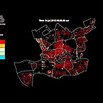
In the next video, Alex Wandl explains on how different forms of sensing technologies and the Geographical Information System (GIS) supported spatial analyses can help to discover the relationship between urban form and liveability. The phenomenon of the Urban Heat Island and its influence on human health and well-being serve as one example (The video 'Urban Heat Island effect', found in Week 4.3.1 provides valuable background knowledge for this video).


